


Protected areas (PAs) have become a strategic component of many environmental regimes and are considered a cornerstone in achieving sustainability. Scientific findings suggest that protected areas can play a critical role in building capacity for adaptation to both climatic and livelihood changes.
However, so far we have had mixed results in the performance of PAs, because of complex challenges in PA governance design and limited synergy between PAs and with wider socio-economic and institutional frameworks.
The Protected Areas and Poverty Reduction (PAPR) project, funded by the Social Sciences and Humanities Research Council of Canada (SSHRC) and the International Development Research Center (IDRC), through the International Community-University Research Alliance Program, set out to understand PAs governance dynamics and to enable knowledge to inform conservation actions.
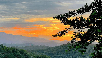
Gazetted in 2005, the Saadani National Park (SNP) is comprised of biologically rich terrestrial, coastal, riverine, wetland and marine ecosystems. SNP, originating from the earlier Saadani Game Reserve (SGR), is Tanzania's newest state-managed PA, part of a network covering no less than 20% of the national territory. Culturally rich, SNP is also connected to 17 villages. Key inquiry areas:


Primary spatial and qualitative, and document data were collected during a 12 month period between 2012 and 2013 in 13 of the 17 villages surrounding the Saadani National Park. The findings here presented come from individual and group interactions with 217 participants.

2. EMERGENCE AND EVOLUTION OF CONSERVATION IN THE SAADANI LANDSCAPE
Detailed spatially-enabled document analysis revealing park actors’ institutional approach to dispossessing villagers from inhabited ancestral territories


Top, original 1974 gazette of the community-initiated Saadani Reserve (SGR). Bottom, TANAPA’s interpretation of the original 1974 agreement. TANAPAs approach to gazetting Uvinjes lands: by adding to where the river enters the ocean and from the mouth of the Mligaji River and by fully omitting: then in a southerly direction along a cleared and beaconed line. When has a cleared beaconed line been made along an ocean shore?

Forced compensation assessment at Uvinje village carried out by Tanzania National Parks Authority (TANAPA) in June 4th and 5th, 2014. Credit: Resident of Uvinje

Overlay of various maps of the Saadani Game Reserve. The basic two differences between the SGR maps from the University of Dar es Salaam and the 2013 doctoral research are: (1) the exact location of the reserves eastern boundary (while the U. Dar es Salaam research used the road between Mkwaja village and Wami river as the boundary line, the doctoral research set the boundary based on the location of 2 original game reserve beacons (~500m to the West of the road)) and; (2) the southern portion of the reserve (U of Dar took Wami River as the southern boundary, while in the doctoral research the boundary tries to follow the land features included in the original gazette notice of the Reserve). Neither one of the two maps developed through independent research include the coastal sub-village areas of Uvinje and Porokanya as part of the original area comprising the reserve.

Oldest Saadani Game Reserve map found so far. Uvinje and its territory are mistakenly designated as “Mbuyuni Village land South of Mligaji River territory Buyuni village is located north of Mligaji River, and Uvinje to the south. In any case, the map is clear that the Game Reserve (no. 3 on the map) does not include the village land. The map is presumed to be the original SGR map which was presented to Uvinje and Saadani elders involved in the establishment of the reserve. Source Map: 1996 Report on Research Commissioned by the Wildlife Division to the University of Dar Es Salaam.

Persistent spatial conflicts (connected to institutional isolation and unilateral decision-making) leading to community disillusionment with state-managed conservation

Aleja Orozco is a PhD student in Geography at the University of Victoria (Canada). Her comparative research titled The Role of Knowledge, Institutions and Multi-level Governance in Adaptive Capacity focuses on the spatial and institutional dynamics of conservation taking place within and around Pacific Rim National Park Reserve (Canada) and Saadani National Park (Tanzania).
For more information on Aleja’s research and activism visit:
http://researchimpacts.wordpress.com/
https://twitter.com/ResearchImpacts
The research project has been funded by,
The International Development Research Centre (IDRC) and the Social Sciences and Humanities Research Council of Canada (SSHRC) through the Protected Areas and Poverty Reduction Canada-Africa Research and Learning Alliance Project. And by
The International Development Research Centre (IDRC) through a Doctoral Research Fellowship Award
Contact: aleja@uvic.ca